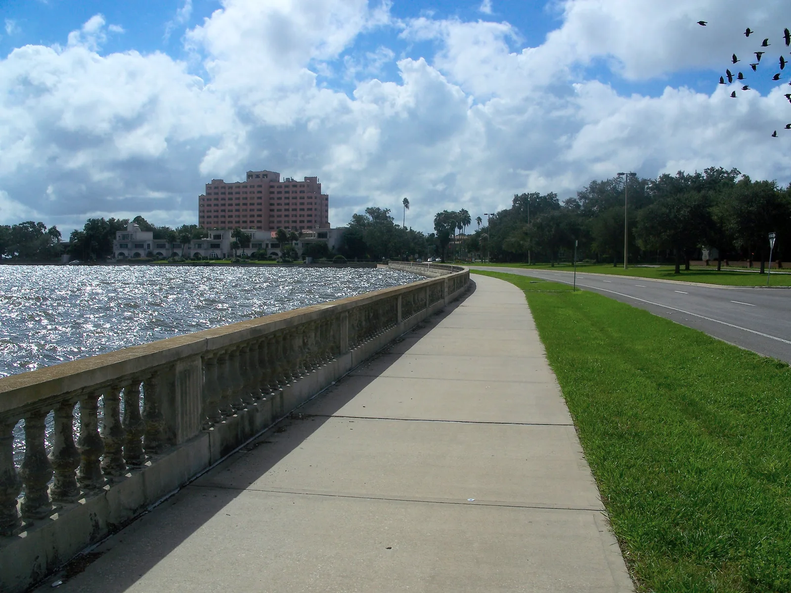
Tampa trails with distances and parking: Bayshore's waterfront sidewalk, the 2.6-mile Riverwalk, the 1.7-mile Selmon Greenway and park loops from 0.9 miles.
Last checked Oct. 10, 2026. Sources: City of Tampa Parks and Recreation’s greenways and trails pages, Friends of the Tampa Riverwalk and the Tampa Hillsborough Expressway Authority. Park administration: 813-274-8615.
Tampa’s longest walks run along the water: Bayshore Boulevard on Hillsborough Bay and the Riverwalk on the Hillsborough River downtown, which connects with the Selmon Greenway. The city’s greenway parks add shorter paved loops, several with nature trails. Distances below are from each operator’s own page.
Who to call
- City park administration: 813-274-8615
- Tampa Police non-emergency: 813-231-6130
- Friends of the Tampa Riverwalk: 813-221-1539
| Trail | Length | Trailhead and parking | Surface |
|---|---|---|---|
| Bayshore Linear Park Trail | Platt Street to Gandy Boulevard; 3-mile bike lane | Ballast Point Park, Fred Ball Park | 10-foot sidewalk |
| Tampa Riverwalk | 2.6 miles | Downtown garages; see below | Waterfront path |
| Selmon Greenway | 1.7 miles | Downtown, under the expressway | Shaded path |
| Al Lopez Park loop | 1.2 miles, plus nature trail | 4810 N. Himes Ave. | 15-foot lighted asphalt |
| MacDill Trail, Gadsden Park | 1.47 miles in two loops | 6901 S. MacDill Ave. | Asphalt |
| Copeland Park | About 1 mile, plus nature trails | 11001 N. 15th St. | Asphalt and boardwalk |
| Cypress Point Park | 0.9 miles, plus 0.44 miles of nature trail | 5620 W. Cypress St. | Asphalt |
| Lowry Park Trail | 0.9 miles | 7252 N. Boulevard | Asphalt |
Bayshore Boulevard
The Bayshore Linear Park Trail, part of the Bayshore Greenway, is a 10-foot-wide sidewalk on the water from Columbus Statue Park at Platt Street south to Gandy Boulevard, open sunrise to sunset. Cyclists can use the three-mile on-road bike lane on the northbound side between Rome Avenue and Gandy Boulevard.
- Parking: Ballast Point Park and Fred Ball Park.
- Along the way: benches, a water fountain, bike parking, fitness stations and a city marina.
- Mile markers: 15 cast bronze markers in the sidewalk, “Winged Figure: From the Firmament” by Michele Oka Doner (1992), mark each mile, half mile and kilometer heading south.
- No fishing along the trail.
The Riverwalk and the Selmon Greenway
The Tampa Riverwalk runs 2.6 miles along the Hillsborough River through downtown (Friends of the Tampa Riverwalk), past Cotanchobee, Curtis Hixon, Julian B. Lane and Water Works parks. Our Riverwalk guide covers it stop by stop.
The Selmon Greenway, run by the Tampa Hillsborough Expressway Authority, is a 1.7-mile path east to west through downtown, mostly in the shade of the Selmon Expressway, and connects with the Riverwalk and the authority’s Meridian Avenue Trail (THEA).
Parking for both: the city’s Riverwalk directions page points drivers from I-275 to Exit 44 or 45A, Downtown West (Ashley/Tampa Street), and the Poe Garage, or from the Selmon Expressway to Exit 7 and the Tampa Convention Center garage. From Ybor City, park in the Ybor garage and ride the streetcar to Cotanchobee, the Marriott or the Convention Center.
Park loops
- Al Lopez Park, 4810 N. Himes Ave., West Tampa Greenway: a 1.2-mile, 15-foot-wide asphalt loop with overhead lighting, with a nature trail through the woods off the northeast side. Parking, restrooms, fishing piers, two ponds, fitness stations and a dog park (trail page). The city advises care when exercising alone on the nature trail.
- MacDill Trail at Gadsden Park, 6901 S. MacDill Ave., South Tampa Greenway: 1.47 miles in two loops, 0.88 miles around Lake Gadsden and 0.59 miles by the play area. Weekends are busy with Interbay Little League (trail page).
- Copeland Park, 11001 N. 15th St., Hillsborough River Greenway: an asphalt trail of about one mile, plus a fitness trail through woods and across wetland boardwalks (trail page).
- Cypress Point Park, 5620 W. Cypress St., West Tampa Greenway: a 0.9-mile asphalt trail and 0.44 miles of nature trail beside a bay beach, with parking, bike racks, restrooms and outdoor showers (trail page).
- Lowry Park Trail, 7252 N. Boulevard, across from ZooTampa: a 0.9-mile asphalt trail along the river through oak hammocks, served by HART routes 44 and 45 (trail page).
Each city trail above is open sunrise to sunset.
What this means for you
- For a long walk or run, Bayshore and the Riverwalk are the city’s longest waterfront routes; the Selmon Greenway connects with the Riverwalk downtown.
- For an evening loop under lights, Al Lopez Park’s 1.2-mile trail is lit.
- Dogs must be leashed on every trail; see our dog-friendly Tampa guide.
More: parks and trails, the Tampa Riverwalk and getting around Tampa.
Frequently asked questions
How long is the Bayshore Boulevard trail?
The Bayshore Linear Park Trail is a 10-foot-wide sidewalk from Columbus Statue Park at Platt Street to Gandy Boulevard. A three-mile on-road bike lane runs on the northbound side between Rome Avenue and Gandy Boulevard.
How long is the Tampa Riverwalk?
The Riverwalk stretches 2.6 miles along the Hillsborough River through downtown, according to Friends of the Tampa Riverwalk.
Where can I park for the Bayshore trail?
The city lists parking at Ballast Point Park and Fred Ball Park. The trail is open sunrise to sunset.
Is there a lighted trail in Tampa?
Al Lopez Park, 4810 N. Himes Ave., has a 1.2-mile, 15-foot-wide asphalt loop with overhead lighting.
Can I fish from the Bayshore trail?
No. The city says fishing is not permitted along the Bayshore trail.
Have your say