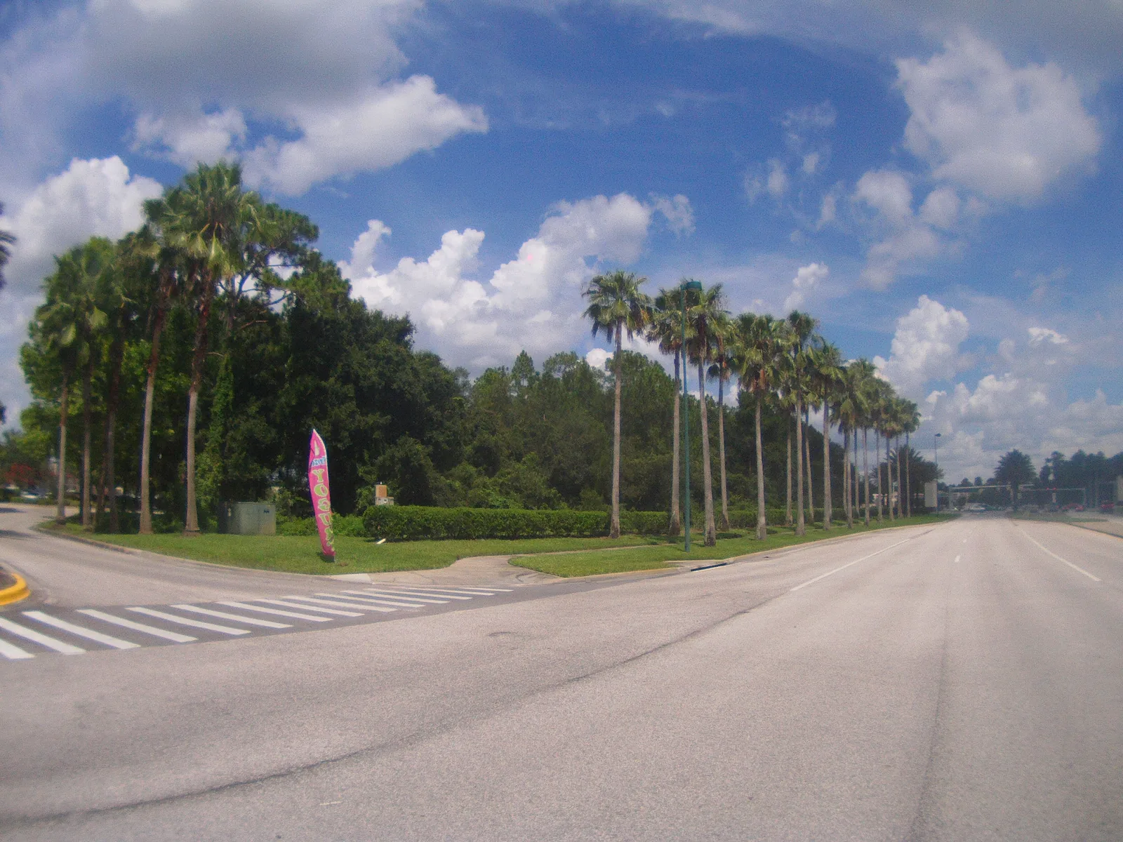
New Tampa is the city's 17,820-acre northern planning district, nearly all in ZIP code 33647, zoned for Wharton or Freedom High.
Last checked Oct. 10, 2026. Sources: the City of Tampa’s planning layers, neighborhood registry, address points and parks map, Hillsborough County Public Schools’ 2026-27 school zones, the Florida Department of Education’s 2026 school grades, the Zillow Home Value Index (Zillow Research), HART schedule data and © OpenStreetMap contributors.
New Tampa is one of the City of Tampa’s five planning districts: about 17,820 acres at the city’s northern end, along Bruce B. Downs Boulevard and I-75. Every one of the 33 deed-restricted communities in the city’s neighborhood registry is here.
What this means for you
- High school: split between Wharton High (48% of addresses, 2026 grade B), Freedom High (48% of addresses, 2026 grade C) and Armwood High (3% of addresses, 2026 grade B).
- Home value: $467,794 in ZIP code 33647 in August 2026, according to the Zillow Home Value Index.
- Nearest interstate exit: I-75 exit 270 (Bruce B. Downs Boulevard), about 1.8 miles by road from New Tampa Community Park.
Part of our Tampa neighborhoods guide.
Where it is
Bruce B. Downs Boulevard runs north and south through the district, with Cross Creek Boulevard, Tampa Palms Boulevard, Commerce Park Boulevard and County Line Road off it. The city’s registry names communities including Tampa Palms, Hunter’s Green, K-Bar Ranch, Cory Lake Isles, Arbor Greene, West Meadows, Grand Hampton, Heritage Isles and Richmond Place. Downtown is about 21 miles south by road.
The city’s address layer has 24,207 address points in the area: 94% in ZIP code 33647, 3% in ZIP code 33637 and 2% in 33613. Of those, 6,913 (29%) carry a unit number.
Schools
From Hillsborough County Public Schools’ 2026-27 attendance zones, matched against every address point in the area:
| Level | Zoned school | Share of addresses | Florida 2026 grade |
|---|---|---|---|
| Elementary | Tampa Palms Elementary, 6100 Tampa Palms Blvd. | 19% | A |
| Elementary | Clark Elementary, 19002 Wood Sage Drive | 18% | A |
| Elementary | Hunter’s Green Elementary, 9202 Highland Oak Drive | 18% | A |
| Elementary | Chiles Elementary, 16541 Tampa Palms Blvd. W. | 13% | A |
| Elementary | Heritage Elementary, 18201 E. Meadow Road | 12% | A |
| K-8 | Turner/Bartels K-8, 9020 Imperial Oak Blvd. | 10% | B |
| Elementary | Pride Elementary, 10310 Lions Den Drive | 6% | A |
| Elementary | Thonotosassa Elementary, 10050 Skewlee Road | 3% | C |
| Middle | Liberty Middle, 17400 Commerce Park Blvd. | 48% | A |
| Middle | Benito Middle, 10101 Cross Creek Blvd. | 38% | A |
| K-8 | Turner/Bartels K-8, 9020 Imperial Oak Blvd. | 10% | B |
| Middle | Jennings Middle, 9325 Governors Run Drive | 3% | C |
| High | Wharton High, 20150 Bruce B. Downs Blvd. | 48% | B |
| High | Freedom High, 17410 Commerce Park Blvd. | 48% | C |
| High | Armwood High, 12000 E. U.S. Highway 92, Seffner | 3% | B |
New Tampa is split between two high school zones, Wharton and Freedom, and among eight elementary zones. Each school name links to its state report card. Zones can change, and an area split between zones is split by street, so check an exact address with the district’s Find Your Neighborhood School lookup. More in our schools guide.
Home values
The typical home value in ZIP code 33647 was $467,794 in August 2026, down 1.9% from $476,630 in August 2025. Zillow’s figure for Tampa as a whole was $377,566, down 0.3%. The Zillow Home Value Index is a modeled typical value for the middle third of homes, single-family houses and condos together, not a sale price. ZIP code 33647 is almost entirely New Tampa, so it is the closest figure to the district itself. More in our home prices guide.
Parks and trails
From the city’s parks map and parks pages:
- New Tampa Community Park, 17302 Commerce Park Blvd.: about 56 acres, with a playground, dog park, pickleball and basketball courts, ball fields, a skate park, gym and recreation center.
- New Tampa Nature Park, 17001 Dona Michelle Drive: about 122 acres, with a playground and nature trails.
- Benito Center, 10065 Cross Creek Blvd.: athletic field and community center.
- New Tampa Regional Library, 10001 Cross Creek Blvd.
More in our parks and trails guide.
Getting around
- I-75: exit 270 (Bruce B. Downs Boulevard), about 1.8 miles by road; exit 275 (State Road 56), about 5.6 miles; exit 266 (Fletcher Avenue and Morris Bridge Road), about 5.7 miles.
- I-275: exit 53 (Bearss Avenue), about 7.3 miles.
- City Hall, 315 E. Kennedy Blvd.: about 20.9 miles by road from New Tampa Community Park, 17302 Commerce Park Blvd..
- Tampa International Airport: about 22.9 miles by road.
- These are distances measured on the OpenStreetMap road network with the OSRM routing engine from New Tampa Community Park, 17302 Commerce Park Blvd. to where each ramp meets its cross street, not drive times. Exit numbers and names are from OpenStreetMap.
- Bus: HART’s August 2026 schedule data shows the 275 New Tampa Limited Express with 19 stops in the district and the 576 HARTFlex East Fletcher service at its southern edge. See HART’s schedules page.
More in our getting around guide.
HOAs and neighborhood associations
The city’s registry lists 33 deed-restricted communities in New Tampa, more than two dozen of them sections of Hunter’s Green, plus Tampa Palms, Tampa Palms North, K-Bar Ranch, Cory Lake Isles, Arbor Greene, West Meadows, Grand Hampton, Heritage Isles, Richmond Place and Easton Park. Deed restrictions usually come with a homeowners association and its dues; ask the seller or the association for the documents before you buy.
Groceries and everyday stores
OpenStreetMap lists three Publix stores (16041 Tampa Palms Blvd. W., 19034 Bruce B. Downs Blvd. and 10928 Cross Creek Blvd.), Sprouts Farmers Market at 8620 Hunters Village Road, an Aldi at 18002 Preserve Walk Lane, Lotte Plaza Market at 17605 Bruce B. Downs Blvd., a Walmart Supercenter at 19910 Bruce B. Downs Blvd., a Winn-Dixie at 6425 County Line Road and a CVS Pharmacy at 6206 Commerce Palms Drive.
How we drew this area
This page follows the New Tampa planning district boundary in the City of Tampa’s planning layers, with community names and types from the city’s neighborhood registry. Because the district is so large, road distances are measured from New Tampa Community Park instead of its geographic middle. School shares count the city’s address points on Oct. 10, 2026, inside each 2026-27 zone; an address point can be a house, an apartment or condo unit or a business. Store locations and road distances use © OpenStreetMap contributors.
Frequently asked questions
What high school is New Tampa zoned for?
It is split almost evenly for 2026-27: about 48% of address points are zoned for Wharton High and 48% for Freedom High, with a few for Armwood High. Wharton earned a B and Freedom a C in Florida’s 2026 grades.
Is New Tampa a good place to live?
Here are the facts. New Tampa is a 17,820-acre planning district of planned communities, with 33 deed-restricted communities in the city registry, a 56-acre community park and a regional library, about 21 miles from City Hall by road. The typical home value in ZIP code 33647 was $467,794 in August 2026, according to Zillow.
What ZIP code is New Tampa?
33647, for about 94% of the district’s address points.
Is New Tampa part of the city of Tampa?
Yes. New Tampa is one of the City of Tampa’s five planning districts, inside city limits.
Have your say