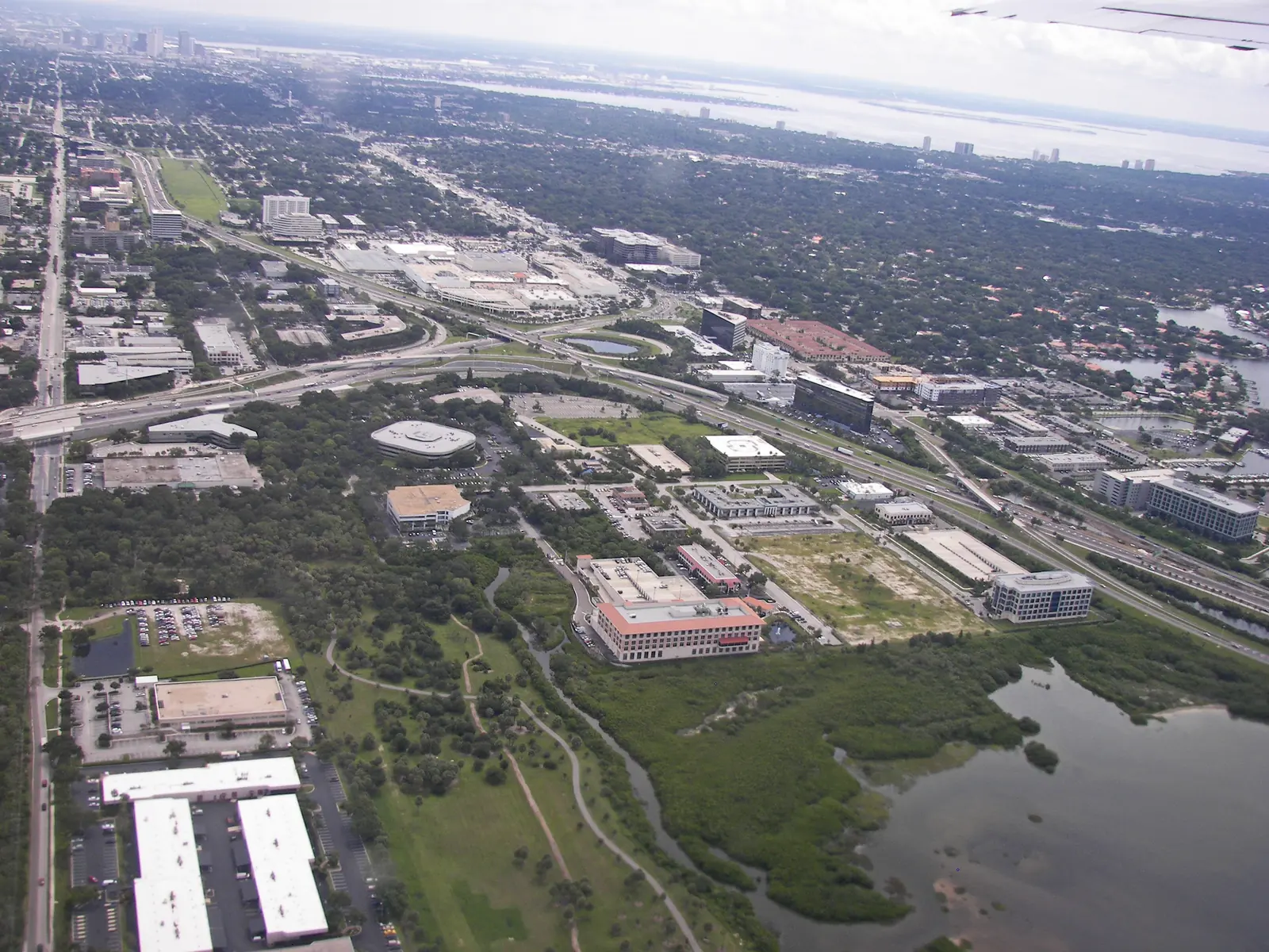
Westshore is Tampa's planning district around the Westshore business district and the airport, mostly in ZIP code 33607, zoned largely for Jefferson High.
Last checked Oct. 10, 2026. Sources: the City of Tampa’s planning layers, neighborhood registry, address points and parks map, Hillsborough County Public Schools’ 2026-27 school zones, the Florida Department of Education’s 2026 school grades, the Zillow Home Value Index (Zillow Research), HART schedule data and © OpenStreetMap contributors.
Westshore is one of the City of Tampa’s five planning districts, listed in the city’s planning layers as “Westshore TIA”: about 6,976 acres that take in the Westshore business district, Tampa International Airport, Raymond James Stadium and the neighborhoods around them. The city’s Westshore business overlay district is inside it, along with streets of houses, apartments and condos.
What this means for you
- High school: split between Jefferson High (69% of addresses, 2026 grade C), Plant High (17% of addresses, 2026 grade A) and Leto High (14% of addresses, 2026 grade B).
- Home value: $362,639 in ZIP code 33607 in August 2026, according to the Zillow Home Value Index.
- Nearest interstate exit: I-275 exit 39 (State Road 60, Kennedy Boulevard and West Shore Boulevard), about 1.3 miles by road.
Part of our Tampa neighborhoods guide.
Where it is
The city’s registry places neighborhoods such as Westshore Palms (I-275 south to Kennedy Boulevard, between Lois Avenue and West Shore Boulevard), North Bon Air and Carver City/Lincoln Gardens inside the district, along with the Drew Park redevelopment area, and lists Raymond James Stadium and the Westshore business area as nonresidential. West Shore Boulevard, Kennedy Boulevard, Dale Mabry Highway, Cypress Street and Hillsborough Avenue are its main roads, and I-275 crosses it. West Tampa, with its own page, is to the east.
The city’s address layer has 11,351 address points in the area: 61% in ZIP code 33607, 19% in ZIP code 33609, 14% in ZIP code 33614 and 6% in 33634. Of those, 6,832 (60%) carry a unit number.
Schools
From Hillsborough County Public Schools’ 2026-27 attendance zones, matched against every address point in the area:
| Level | Zoned school | Share of addresses | Florida 2026 grade |
|---|---|---|---|
| Elementary | Dickenson Elementary, 4720 Kelly Road | 56% | B |
| Elementary | Grady Elementary, 3910 W. Morrison Ave. | 15% | A |
| Elementary | Alexander Elementary, 5602 N. Lois Ave. | 14% | A |
| Elementary | Tampa Bay Boulevard Elementary, 3111 W. Tampa Bay Blvd. | 7% | C |
| Elementary | West Tampa Elementary, 2700 W. Cherry St. | 5% | A |
| Middle | Pierce Middle, 5511 N. Hesperides St. | 54% | C |
| Middle | Webb Middle, 6035 Hanley Road | 23% | C |
| Middle | Coleman Middle, 1724 S. Manhattan Ave. | 15% | A |
| Middle | Madison Middle, 4444 W. Bay Vista Ave. | 5% | C |
| High | Jefferson High, 4401 W. Cypress St. | 69% | C |
| High | Plant High, 2415 S. Himes Ave. | 17% | A |
| High | Leto High, 4409 W. Sligh Ave. | 14% | B |
Most of the district is zoned for Jefferson High, with the rest split between Plant and Leto. Each school name links to its state report card. Zones can change, and an area split between zones is split by street, so check an exact address with the district’s Find Your Neighborhood School lookup. More in our schools guide.
Home values
The typical home value in ZIP code 33607 was $362,639 in August 2026, up 0.1% from $362,140 in August 2025. Zillow’s figure for Tampa as a whole was $377,566, down 0.3%. In ZIP code 33609 it was $608,955, down 1.4%. In ZIP code 33614 it was $353,254, up 1.8%. The Zillow Home Value Index is a modeled typical value for the middle third of homes, single-family houses and condos together, not a sale price. All three ZIP codes reach beyond the district, so none of the figures is Westshore’s alone. More in our home prices guide.
Parks and trails
From the city’s parks map and parks pages:
- Al Lopez Park, 4810 N. Himes Ave.: about 132 acres, with playgrounds, a dog park, trails, a fishing pier and the Cordelia B. Hunt Community Center.
- Cypress Point Park, 5620 W. Cypress St.: beach, canoe launch, trails and disc golf on Old Tampa Bay.
- Loretta Ingraham Park and complex, 1615 N. Hubert Ave.: pool, gym and fitness center.
- Lincoln Gardens Park, 4020 W. Palmetto St., and Charles B. Williams Park, 309 N. Hubert Ave.
- Jim Walter Park, 1508 N. Grady Ave., and Rocky Point Golf Course, 4151 Dana Shores Drive.
- Ben T. Davis Beach on the Courtney Campbell Causeway.
More in our parks and trails guide.
Getting around
- I-275: exit 39 (State Road 60, Kennedy Boulevard and West Shore Boulevard), about 1.3 miles by road; exit 40B (Lois Avenue and International Plaza), about 1.8 miles; exit 41A (Dale Mabry Highway), about 2 miles.
- City Hall, 315 E. Kennedy Blvd.: about 6.0 miles by road.
- Tampa International Airport: about 3.2 miles by road.
- These are distances measured on the OpenStreetMap road network with the OSRM routing engine from the middle of the area to where each ramp meets its cross street, not drive times. Exit numbers and names are from OpenStreetMap.
- Bus: HART’s August 2026 schedule data shows eight routes stopping in the district, among them 45 (University Area/Westshore), 10 (Cypress Street), 36 (Dale Mabry Highway/Himes Avenue), 30 (Kennedy Boulevard/Town N Country) and 34 (Hillsborough Avenue). See HART’s schedules page.
More in our getting around guide.
HOAs and neighborhood associations
The city’s registry lists Westshore Palms, North Bon Air and Carver City/Lincoln Gardens as active neighborhood associations. None is listed as deed-restricted.
Groceries and everyday stores
OpenStreetMap lists a Whole Foods Market at 3740 W. Cypress St., a Walmart Supercenter at 1505 N. Dale Mabry Hwy., a Walgreens at 4651 W. Kennedy Blvd. and a CVS Pharmacy on West Laurel Street inside the district, and a Publix at 4900 W. Kennedy Blvd. at its edge.
How we drew this area
This page follows the Westshore TIA planning district boundary in the City of Tampa’s planning layers, with association boundaries from the city’s neighborhood registry. School shares count the city’s address points on Oct. 10, 2026, inside each 2026-27 zone; an address point can be a house, an apartment or condo unit or a business. Store locations and road distances use © OpenStreetMap contributors.
Frequently asked questions
What high school is Westshore zoned for?
Mostly Jefferson High, for about 69% of address points in 2026-27, with 17% zoned for Plant High and 14% for Leto High. Plant earned an A, Leto a B and Jefferson a C in Florida’s 2026 grades.
Is Westshore a good place to live?
Here are the facts. Westshore is a 6,976-acre planning district around the business district and the airport, with Al Lopez Park, Cypress Point Park and other city parks, about 1.3 miles from I-275. The typical home value in ZIP code 33607 was $362,639 in August 2026, according to Zillow.
What ZIP code is Westshore in Tampa?
Mostly 33607 (61% of address points), with 33609, 33614 and 33634.
How far is Westshore from Tampa International Airport?
The airport is inside the district; from its middle it is about 3.2 miles by road, measured on the OpenStreetMap road network.
Have your say