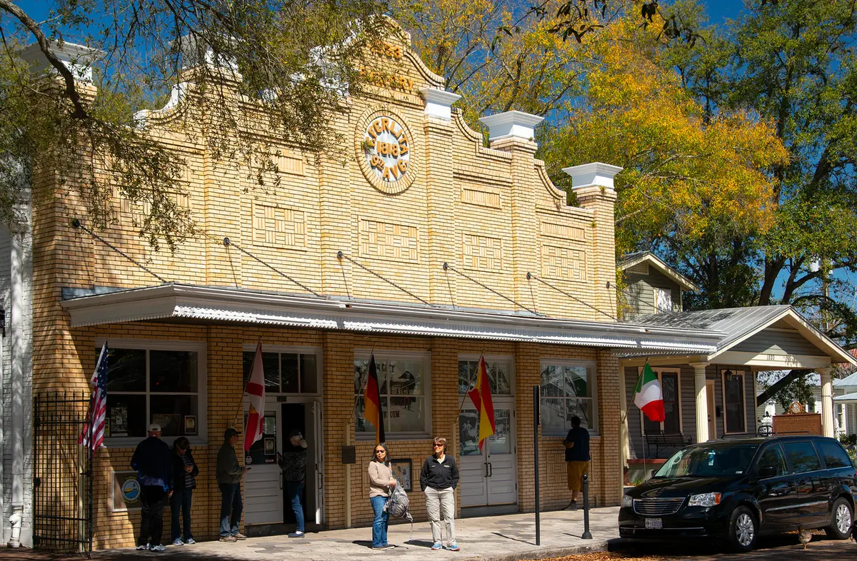
Ybor City is a 410-acre historic urban village northeast of downtown Tampa in ZIP code 33605, zoned for Middleton or Blake High.
Last checked Oct. 10, 2026. Sources: the City of Tampa’s planning layers, neighborhood registry, address points and parks map, Hillsborough County Public Schools’ 2026-27 school zones, the Florida Department of Education’s 2026 school grades, the Zillow Home Value Index (Zillow Research), HART schedule data and © OpenStreetMap contributors.
Ybor City is one of the City of Tampa’s nine urban villages, about 410 acres northeast of downtown, and a local historic district the city first listed in 1975. The city’s registry notes that it is named for cigar factory owner Vicente M. Ybor, who built it to house his factories and their workers.
What this means for you
- High school: split between Middleton High (52% of addresses, 2026 grade B) and Blake High (48% of addresses, 2026 grade C).
- Home value: $262,404 in ZIP code 33605 in August 2026, according to the Zillow Home Value Index.
- Nearest interstate exit: I-4 exit 1 (21st and 22nd streets), about 0.8 mile by road.
Part of our Tampa neighborhoods guide.
Where it is
The city’s registry gives the Historic Ybor neighborhood association’s boundaries as I-4 on the north, Adamo Drive on the south, 22nd Street on the east and Nebraska Avenue on the west. Seventh Avenue and Eighth Avenue run east and west through it. East Tampa, with its own page, is to the north and east, and the Channel District, also with a page, is to the south.
All 2,643 of the area’s address points in the city’s address layer are in ZIP code 33605. Of those, 1,579 (60%) carry a unit number.
Schools
From Hillsborough County Public Schools’ 2026-27 attendance zones, matched against every address point in the area:
| Level | Zoned school | Share of addresses | Florida 2026 grade |
|---|---|---|---|
| Elementary | B.T. Washington Elementary, 1407 Estelle St. | 100% | B |
| Middle | Stewart Middle Magnet, 1125 W. Spruce St. | 100% | B |
| High | Middleton High, 4801 N. 22nd St. | 52% | B |
| High | Blake High, 1701 N. Boulevard | 48% | C |
The high school zone line runs through the district: about half of its addresses are zoned for Middleton and half for Blake. Each school name links to its state report card. Zones can change, and an area split between zones is split by street, so check an exact address with the district’s Find Your Neighborhood School lookup. More in our schools guide.
Home values
The typical home value in ZIP code 33605 was $262,404 in August 2026, down 0.1% from $262,633 in August 2025. Zillow’s figure for Tampa as a whole was $377,566, down 0.3%. The Zillow Home Value Index is a modeled typical value for the middle third of homes, single-family houses and condos together, not a sale price. ZIP code 33605 also covers East Ybor and parts of East Tampa, so the figure is not Ybor City’s alone. More in our home prices guide.
Parks and trails
From the city’s parks map and parks pages:
- Centennial Park, 1800 E. Eighth Ave.: trails, shade shelters and restrooms.
- Jose Marti Park, 1303 E. Eighth Ave.
- East Ybor Park, 2202 N. 26th St., just east of the district: playground, basketball court and shelters.
- Robert W. Saunders Sr. Public Library, 1505 N. Nebraska Ave.
More in our parks and trails guide.
Getting around
- I-4: exit 1 (21st and 22nd streets), about 0.8 mile by road.
- I-275: exit 46A (Floribraska Avenue), about 1.5 miles; exit 45A (Downtown East-West), about 1.7 miles.
- City Hall, 315 E. Kennedy Blvd.: about 2.3 miles by road.
- Tampa International Airport: about 8.9 miles by road.
- These are distances measured on the OpenStreetMap road network with the OSRM routing engine from the middle of the area to where each ramp meets its cross street, not drive times. Exit numbers and names are from OpenStreetMap.
- Streetcar and bus: the free TECO Line Streetcar has four stops in Ybor City. HART’s August 2026 schedule data shows routes 5 (40th Street), 12 (22nd Street), 8, 9 (15th/30th Street) and 400 (Nebraska Avenue) stopping here. See HART’s schedules page.
More in our getting around guide.
HOAs and neighborhood associations
The city’s registry lists the Historic Ybor neighborhood association as active. The registry’s entries are voluntary neighborhood groups, not mandatory homeowners associations.
Groceries and everyday stores
OpenStreetMap lists no supermarket or pharmacy inside the district. The nearest supermarkets on the map are a Publix at 1105 Twiggs St. in the Channel District, about 0.4 mile south, and Duckweed Urban Grocery at 117 N. 12th St., about half a mile away.
How we drew this area
This page follows the Ybor City urban village boundary in the City of Tampa’s planning layers, with association boundaries and history from the city’s neighborhood registry. School shares count the city’s address points on Oct. 10, 2026, inside each 2026-27 zone; an address point can be a house, an apartment or condo unit or a business. Store locations and road distances use © OpenStreetMap contributors.
Frequently asked questions
What high school is Ybor City zoned for?
It is split: about 52% of the district’s address points are zoned for Middleton High and 48% for Blake High for 2026-27. Elementary and middle students are zoned for B.T. Washington Elementary and Stewart Middle Magnet.
Is Ybor City a good place to live?
Here are the facts. Ybor City is a 410-acre historic district with two city parks, four streetcar stops and an I-4 exit about 0.8 mile away. The typical home value in ZIP code 33605 was $262,404 in August 2026, according to Zillow.
What ZIP code is Ybor City?
33605, for nearly every address point in the district.
Is Ybor City a historic district?
Yes. The City of Tampa’s planning layers list Ybor City as a local historic district, first listed in 1975.
Have your say